Log in
All resources
Create a design
1,095,865 Free Images of Maps Of Chaldea
atlas of the russian empire (1800)
maps made in the 17th century
atlantis magni tomus tertius (biblioteca comunale di trento)
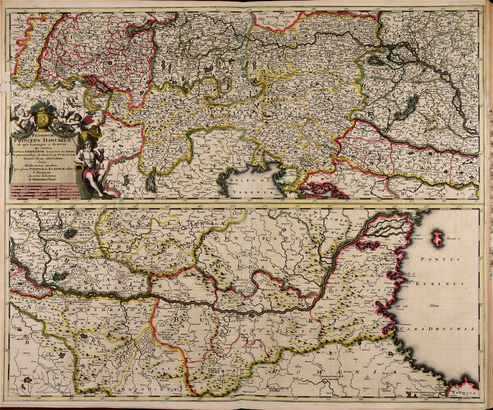
maps made in the 18th century
atlas beudeker
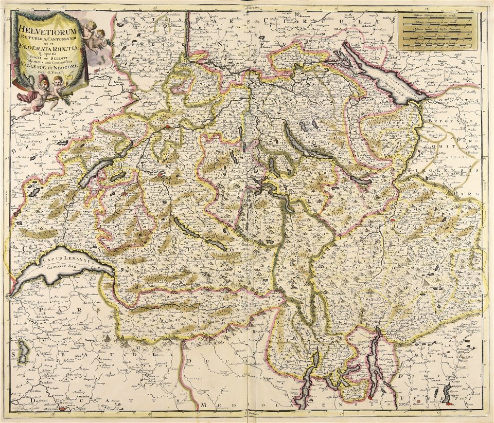
gerard valck
moses pitt
atlantis magni tomus primus (biblioteca comunale di trento)
jan janssonius
atlantis magni tomus quintus (biblioteca comunale di trento)
atlantis magni tomus tertius (biblioteca comunale di trento)
maps made in the 18th century
grand
bill
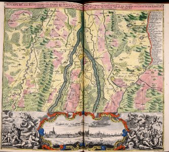
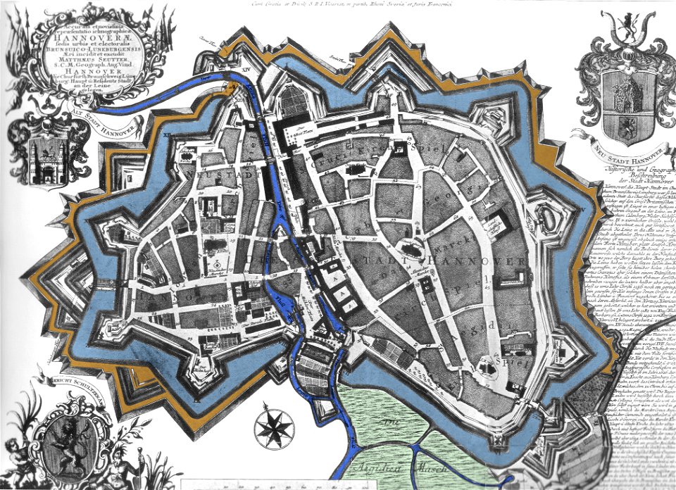
maps by matthäus seutter
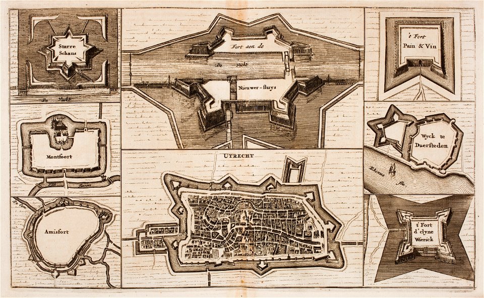
city walls in hannover
maps made in the 17th century
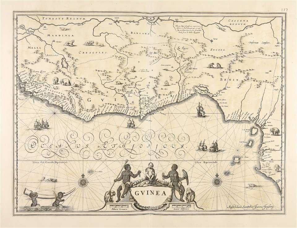
old maps of guinea
maps made in the 18th century
gerard valck
cornell university library
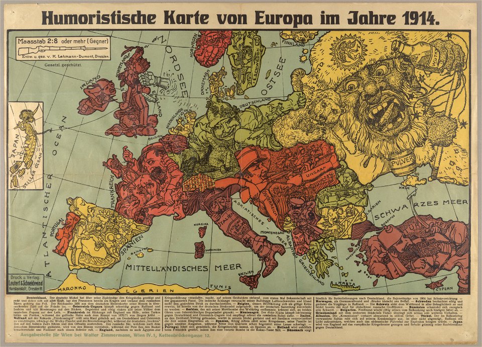
political cartoons
dell'arcano del mare
harvard university
maps made in the 17th century
danimarca
dutch 17th-century prints in the rijksmuseum amsterdam
netherlands
maps made in the 17th century
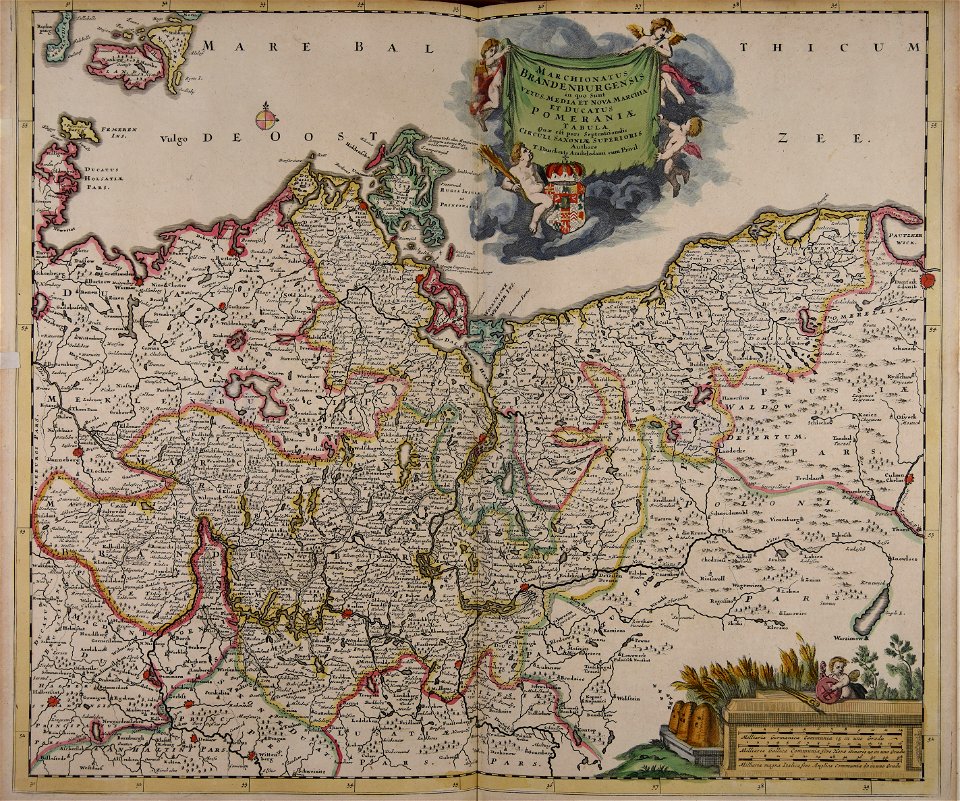
old maps of brandenburg
atlantis magni tomus tertius (biblioteca comunale di trento)
maps made in the 17th century
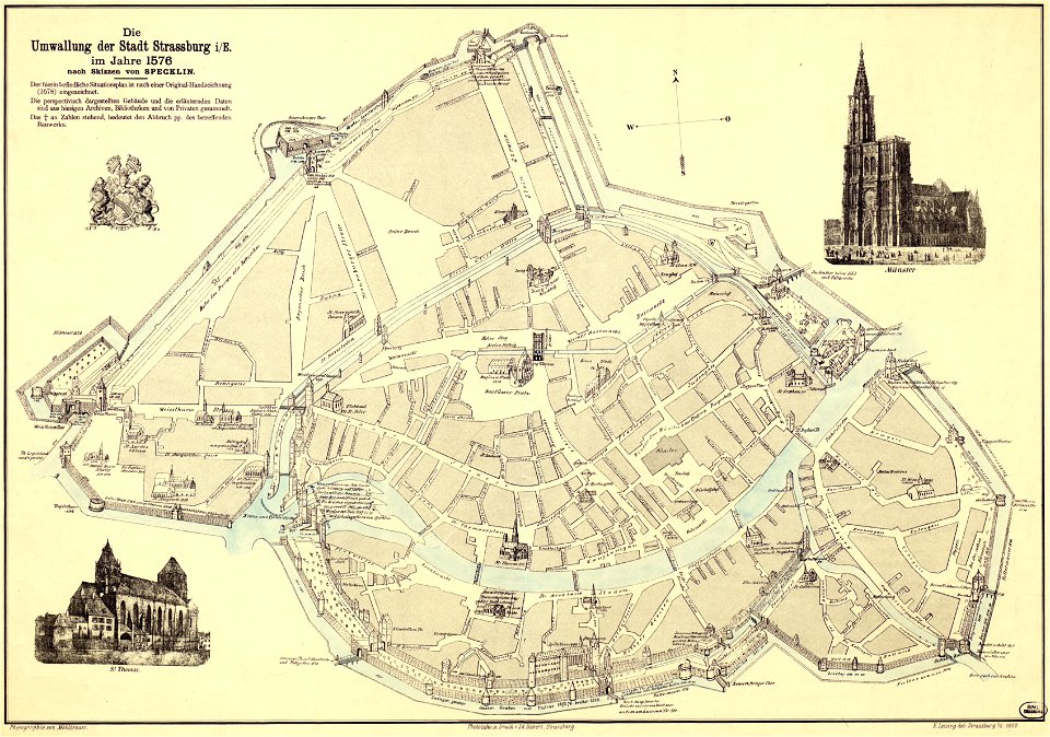
collections de la bibliothèque nationale et universitaire de strasbourg
maps by daniel specklin
engravings in the rijksmuseum amsterdam
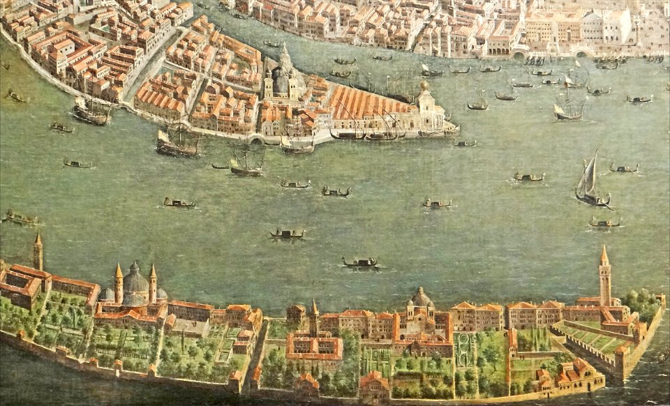
old maps of venice
popular science monthly illustrations/volume 32
low pressure systems
atlantis magni tomus quartus (biblioteca comunale di trento)
maps by nicolaes visscher i
maps by willem and johannes blaeu
old maps of rotterdam
maps made in the 17th century
cornelis danckerts (i)
maps made in the 17th century
old maps of skåne
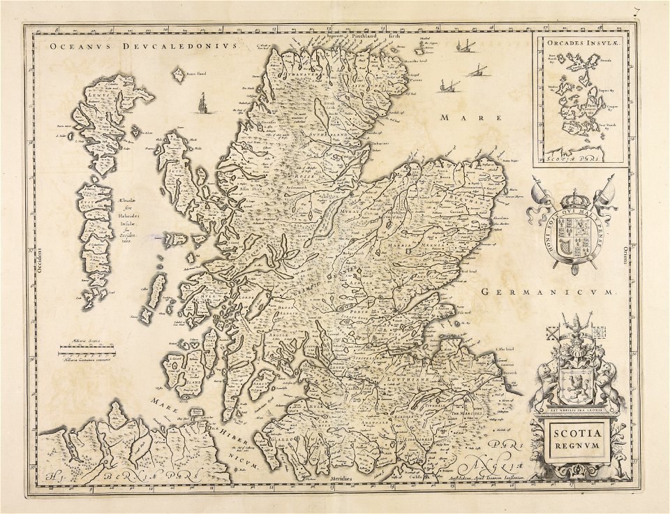
maps made in the 17th century
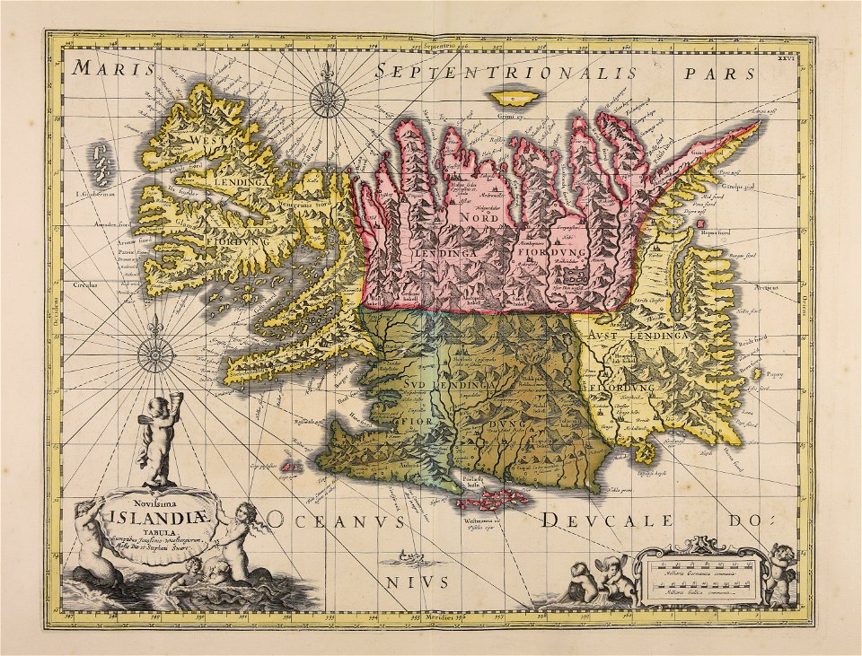
old maps of iceland
maps made in the 18th century
gerard valck
maps made in the 18th century
gerard valck
maps made in the 18th century
gerard valck
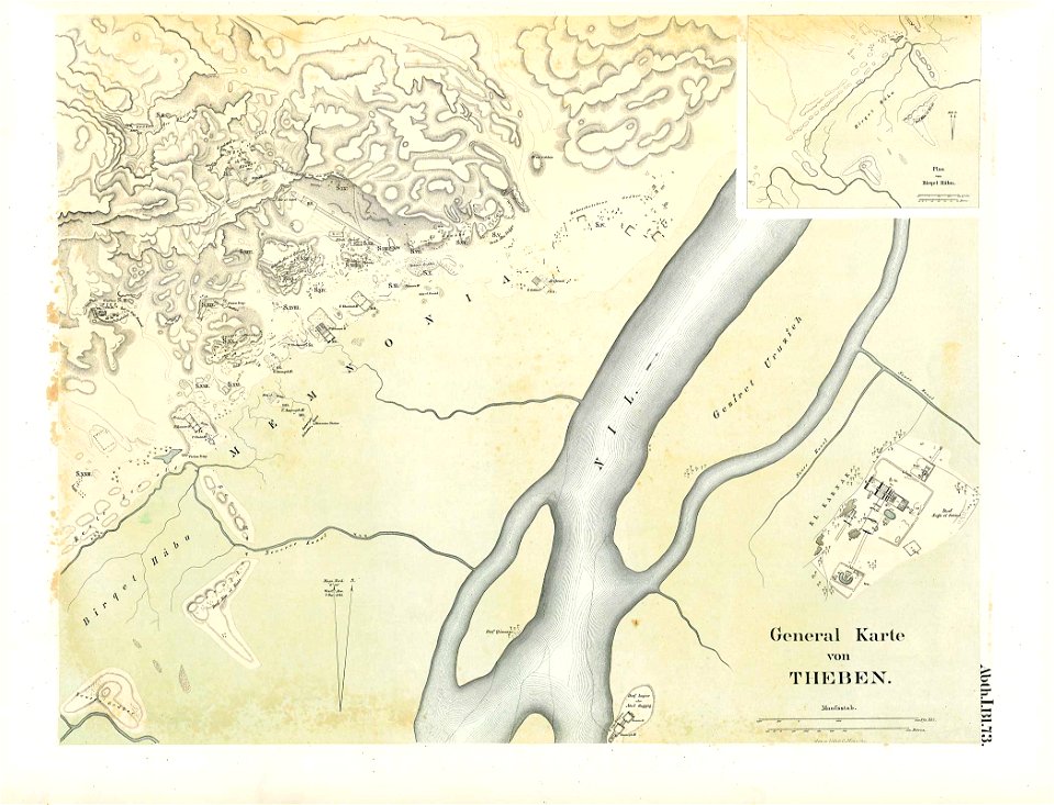
karnak temple complex
thebes
maps made in the 17th century
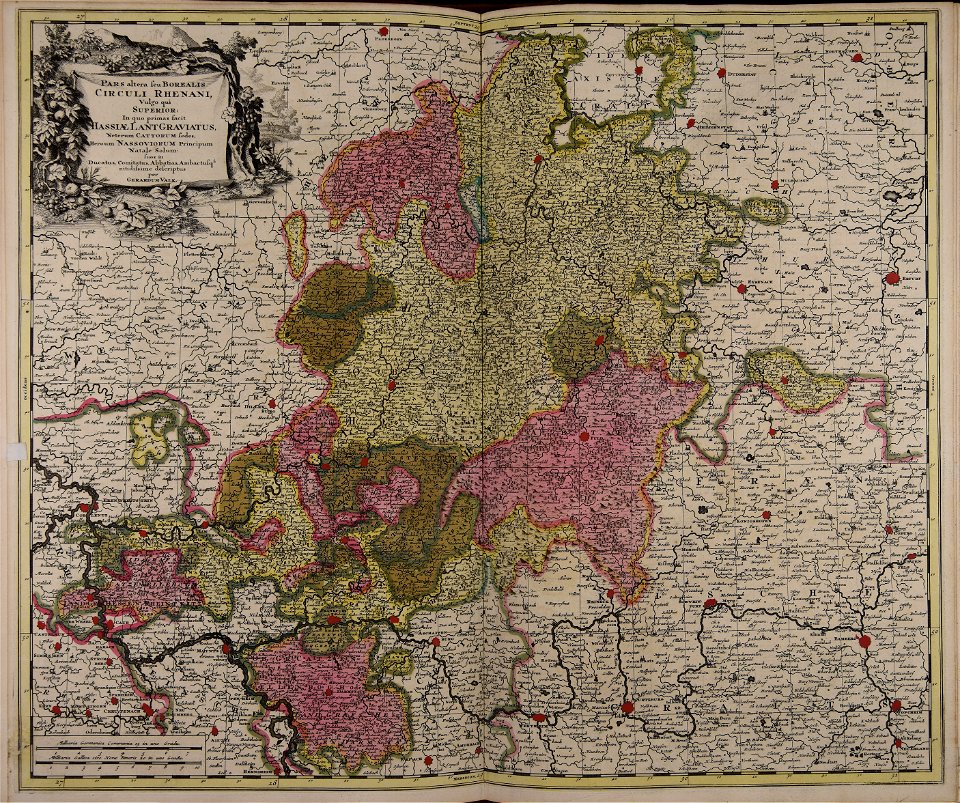
old maps of alsace
maps made in the 17th century
jan janssonius
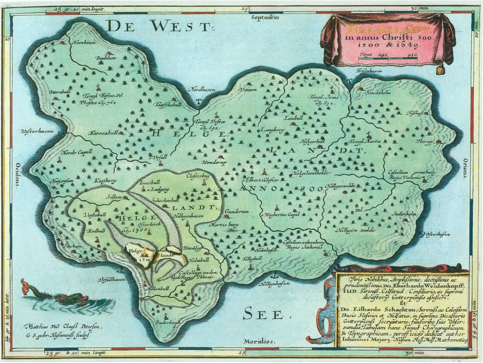
helgeladt in annis christi 800
1300 & 1649
prints from the peace palace library
utrecht in the 18th century
drawings in the stadsarchief amsterdam
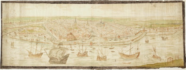
anthonis van den wijngaerde
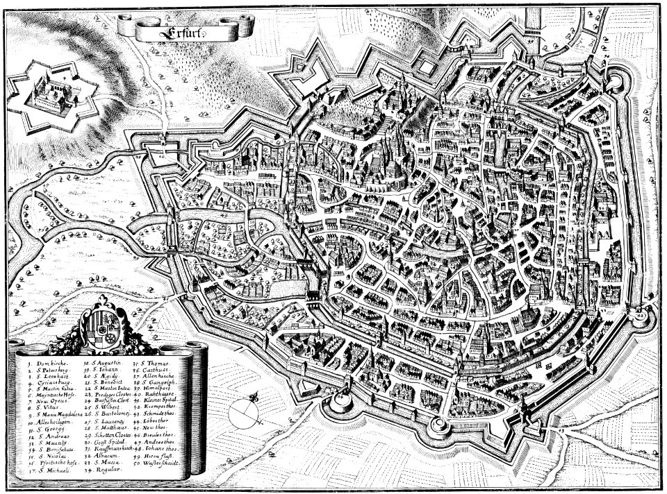
maps of erfurt
erfurt
1712 maps of puerto rico
johannes van keulen
university of toronto wenceslas hollar digital collection
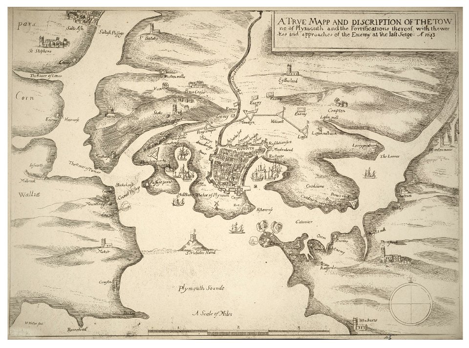
english civil war
paintings of san giorgio maggiore (venice)
17th-century paintings from italy
mannheim in the 17th century
maps of mannheim
maps of waterways in the netherlands
collections of stadsarchief delft
people with globes in art
1628 maps
historical images of pont au change
lithographs of paris
isabella of portugal (workshop of rogier van der weyden, getty center)
early netherlandish painting
bird's-eye views of paris
axe historique
animal shape
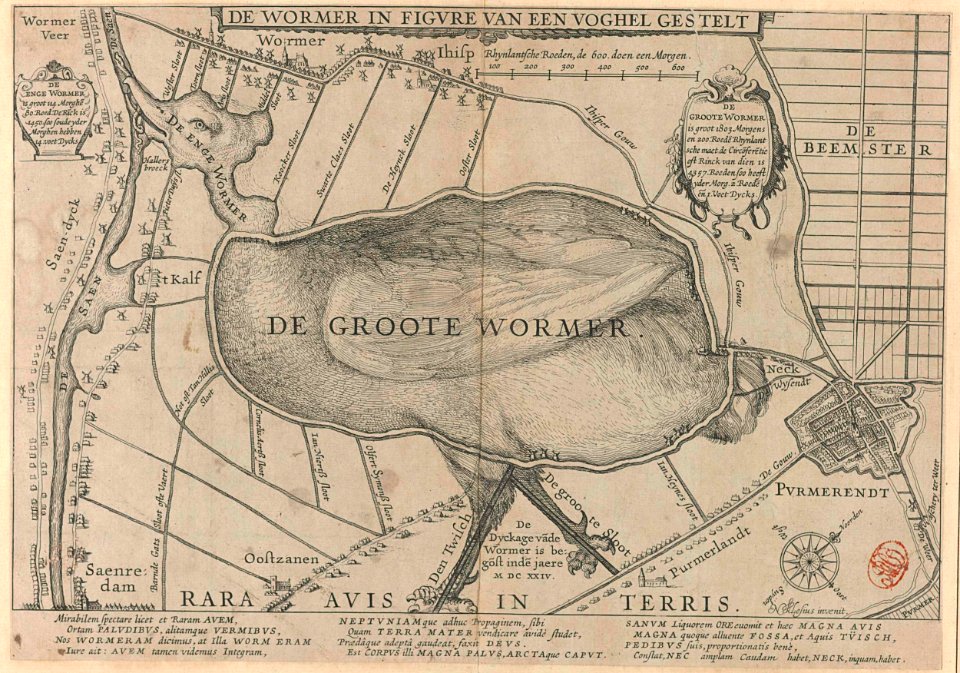
purmerend
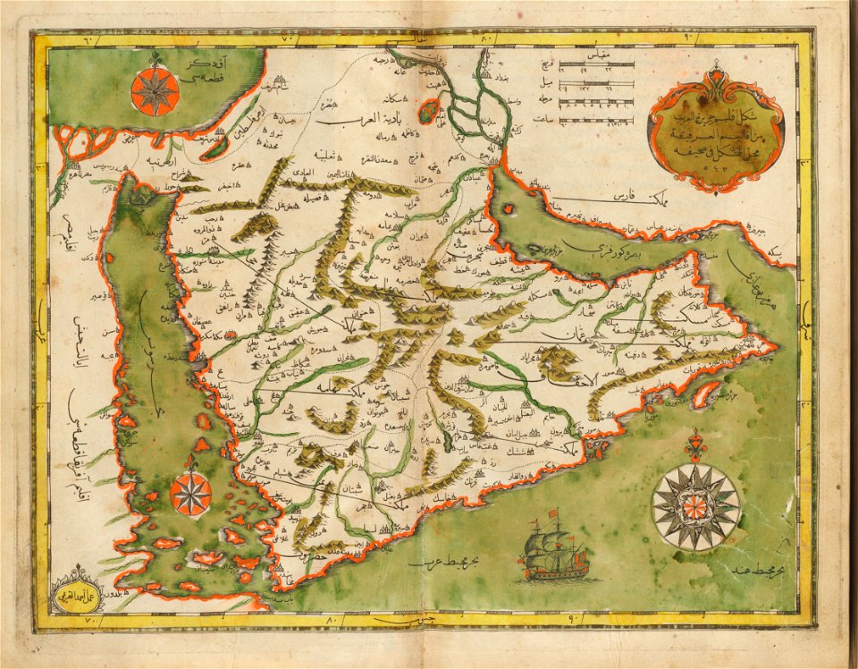
old maps of the middle east
harvard university
fortifications in the netherlands
wijk bij duurstede
new market square in rzeszów
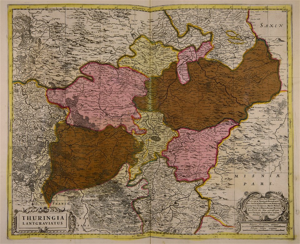
maps of 18th-century europe
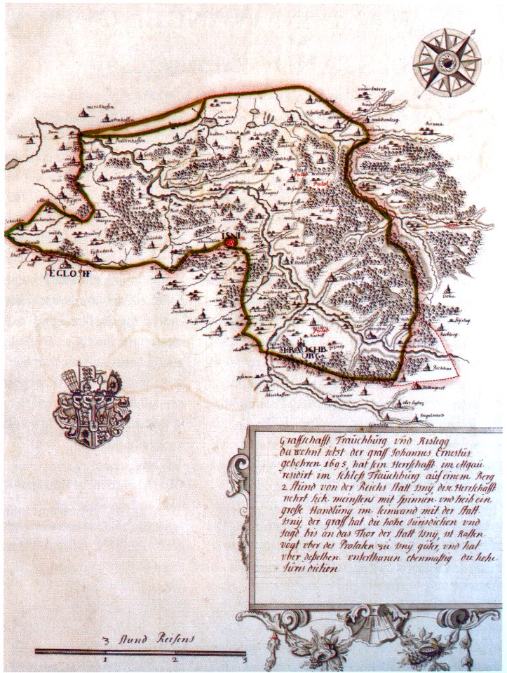
waldburg (adelsfamilie)
coats of arms on maps
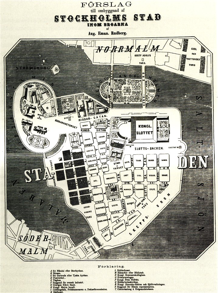
maps of gamla stan
1862 in stockholm
geographical illustrations by coronelli
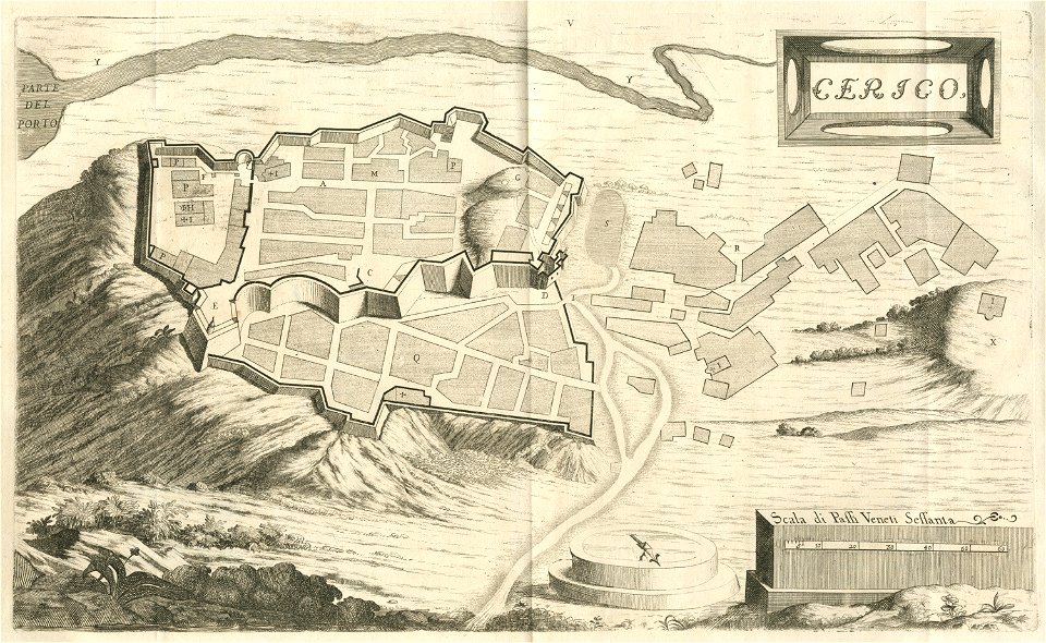
engravings of kythira
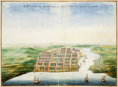
history of the dominican republic
1665
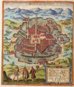
maps of the historic center of mexico city
braun & hogenberg
historical images of aden
asia noviter delineata
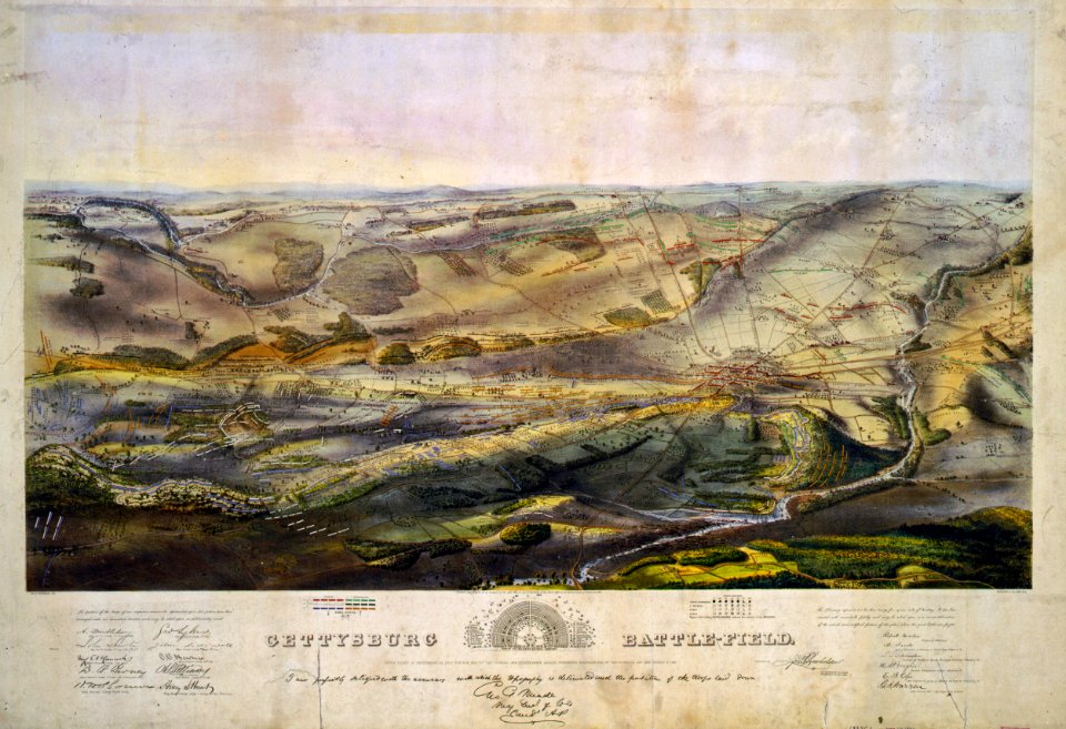
gettysburg battlefield
endicott & co.
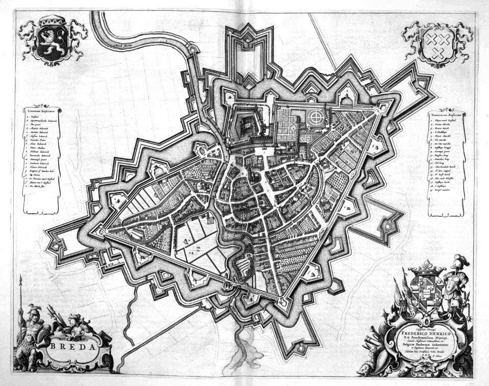
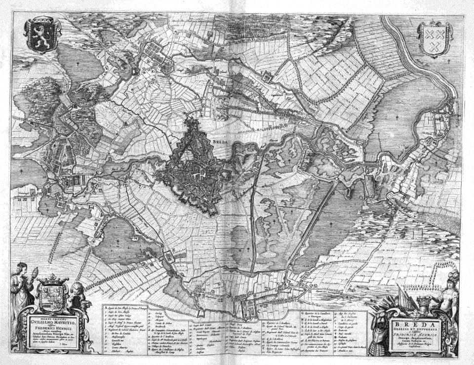
old maps of breda
atlas beudeker
old maps of breda
atlas beudeker
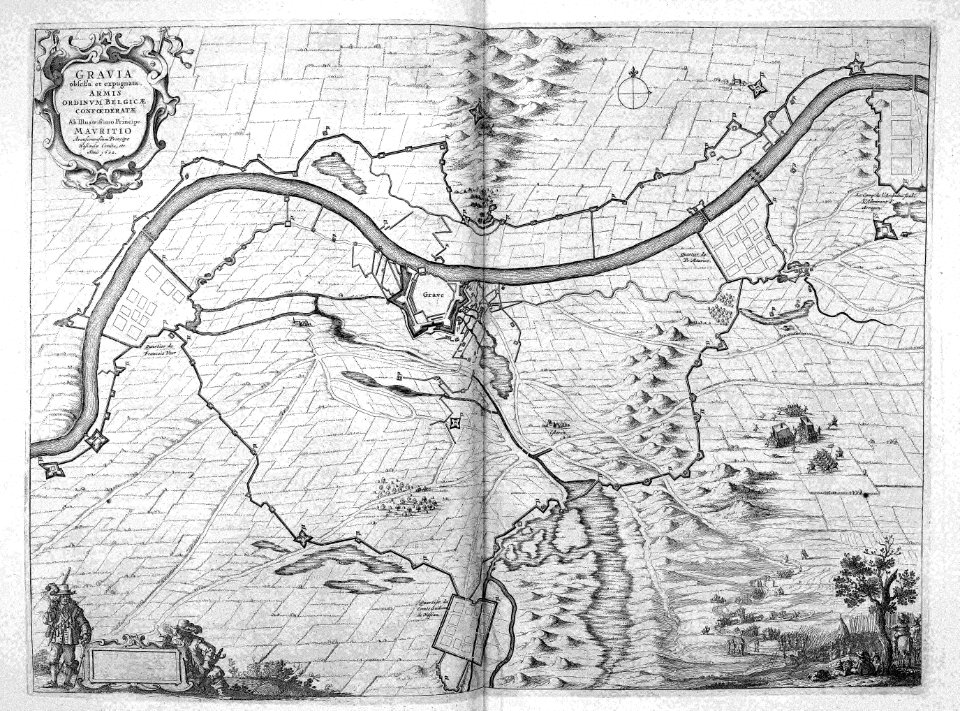
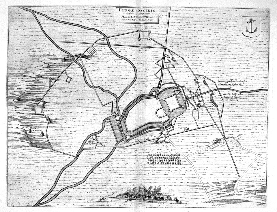
siege of grave 1602
netherlands
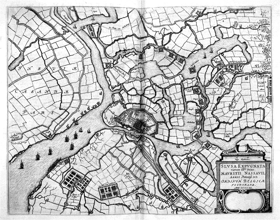
siege of sluis 1604
atlas beudeker
maps of lingen (ems)
atlas beudeker
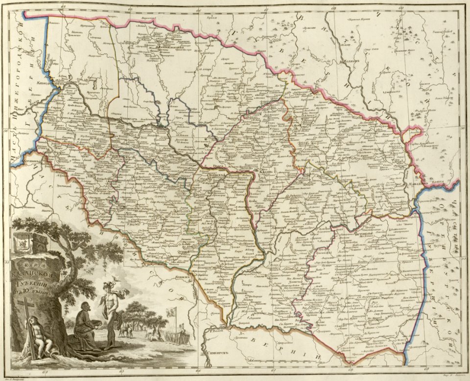
atlas of the russian empire (1800)
maps of kazan governorate
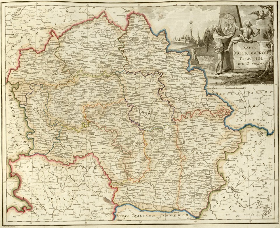
atlas of the russian empire (1800)
maps of moscow governorate
atlas of the russian empire (1800)
maps of pskov governorate
atlas of the russian empire (1800)
maps of vyatka governorate
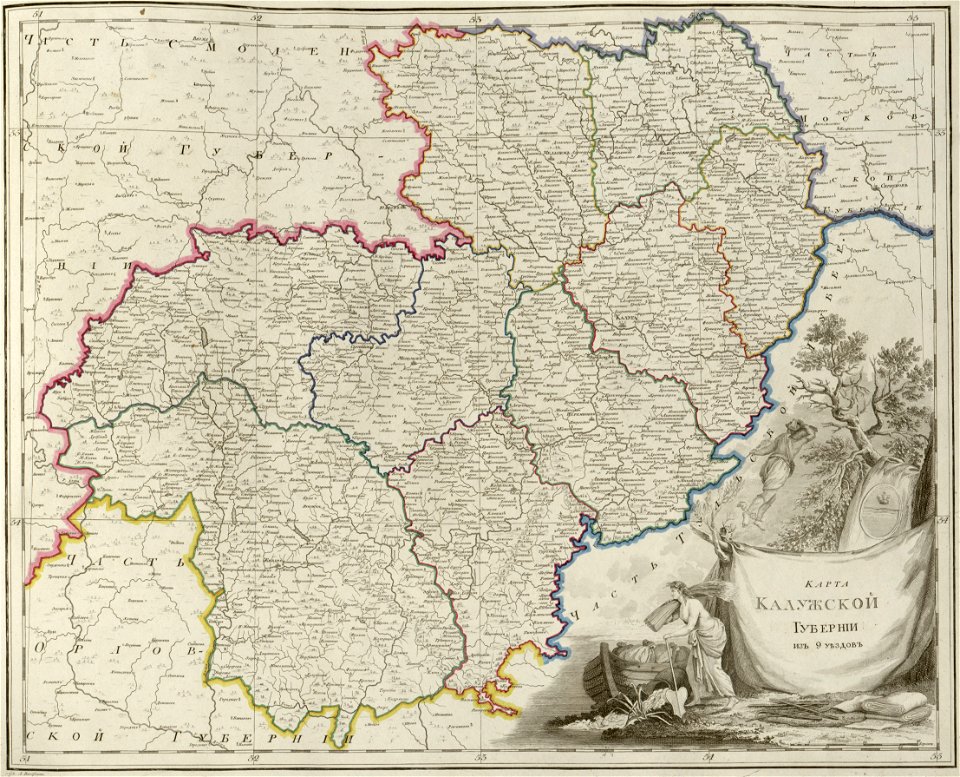
atlas of the russian empire (1800)
maps of kaluga governorate
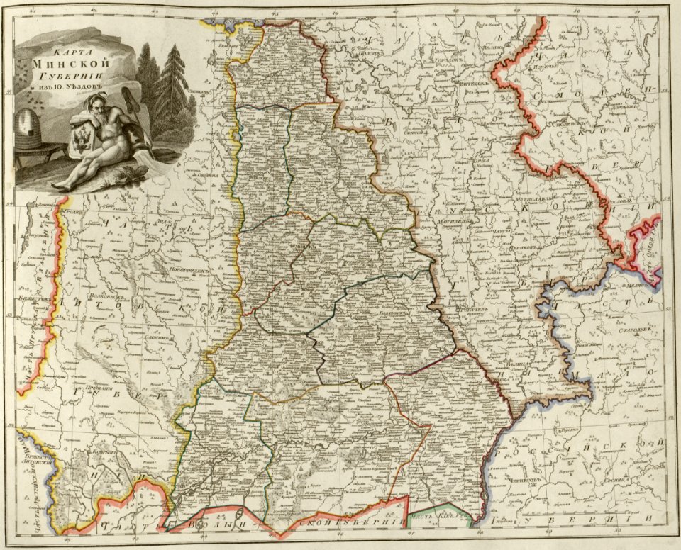
atlas of the russian empire (1800)
maps of minsk governorate
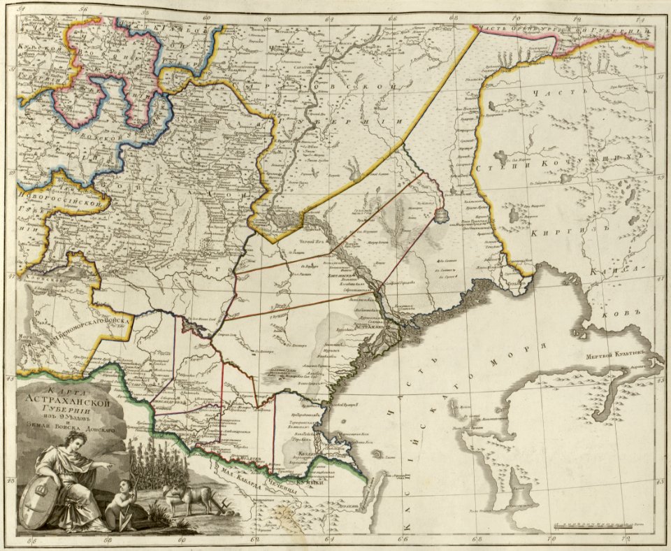
atlas of the russian empire (1800)
maps of astrakhan governorate
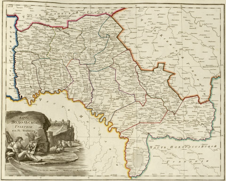
atlas of the russian empire (1800)
maps of podolia governorate
atlas of the russian empire (1800)
maps of kursk governorate
atlas of the russian empire (1800)
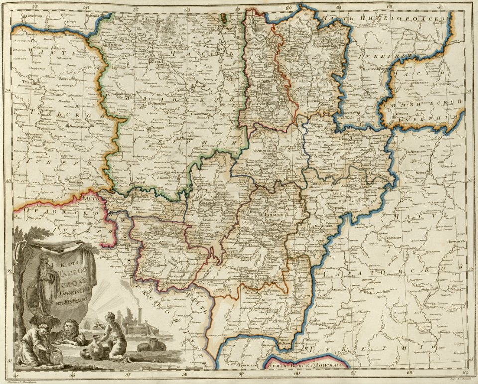
maps of tambov governorate
atlas of the russian empire (1800)
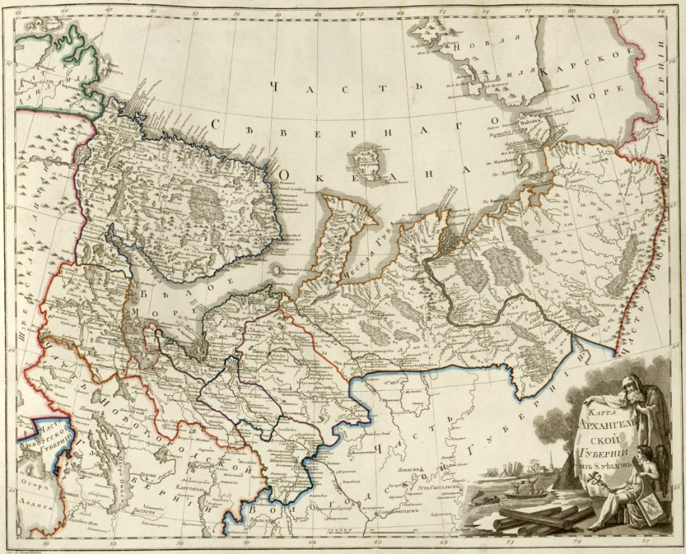
maps of arkhangelsk governorate
atlas of the russian empire (1800)
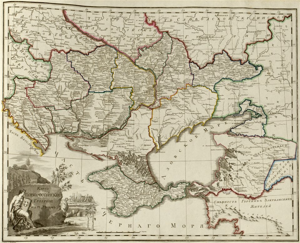
maps of novorossia governorate
atlas of the russian empire (1800)
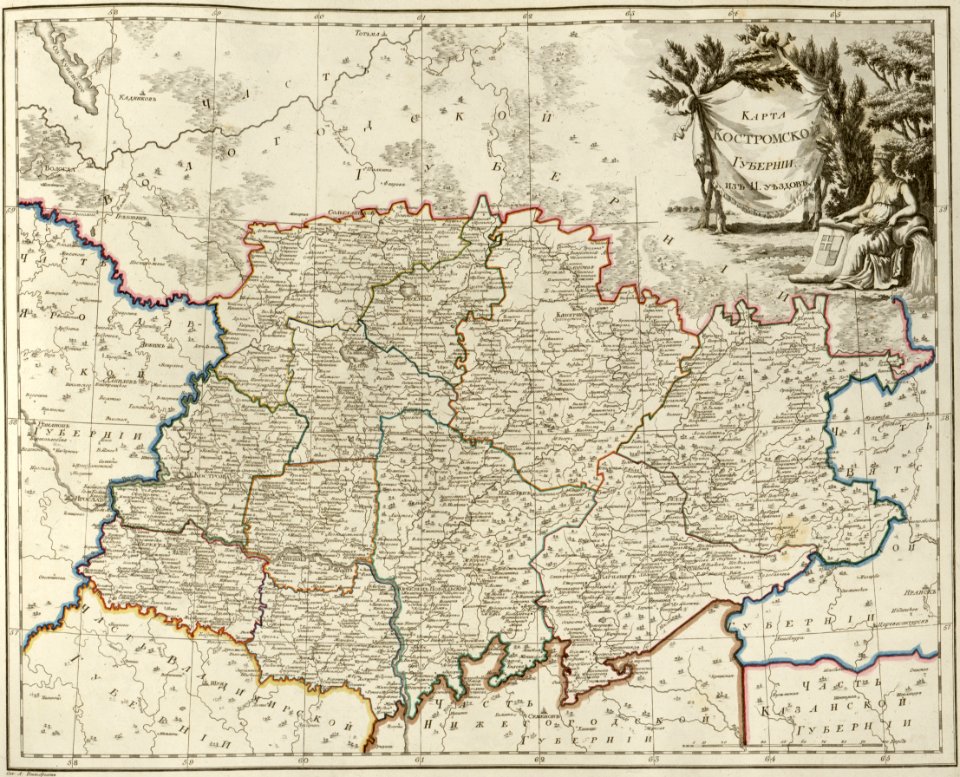
maps of kostroma governorate
atlas of the russian empire (1800)
maps of saratov governorate
atlas of the russian empire (1800)
maps of estlandia governorate
atlas of the russian empire (1800)
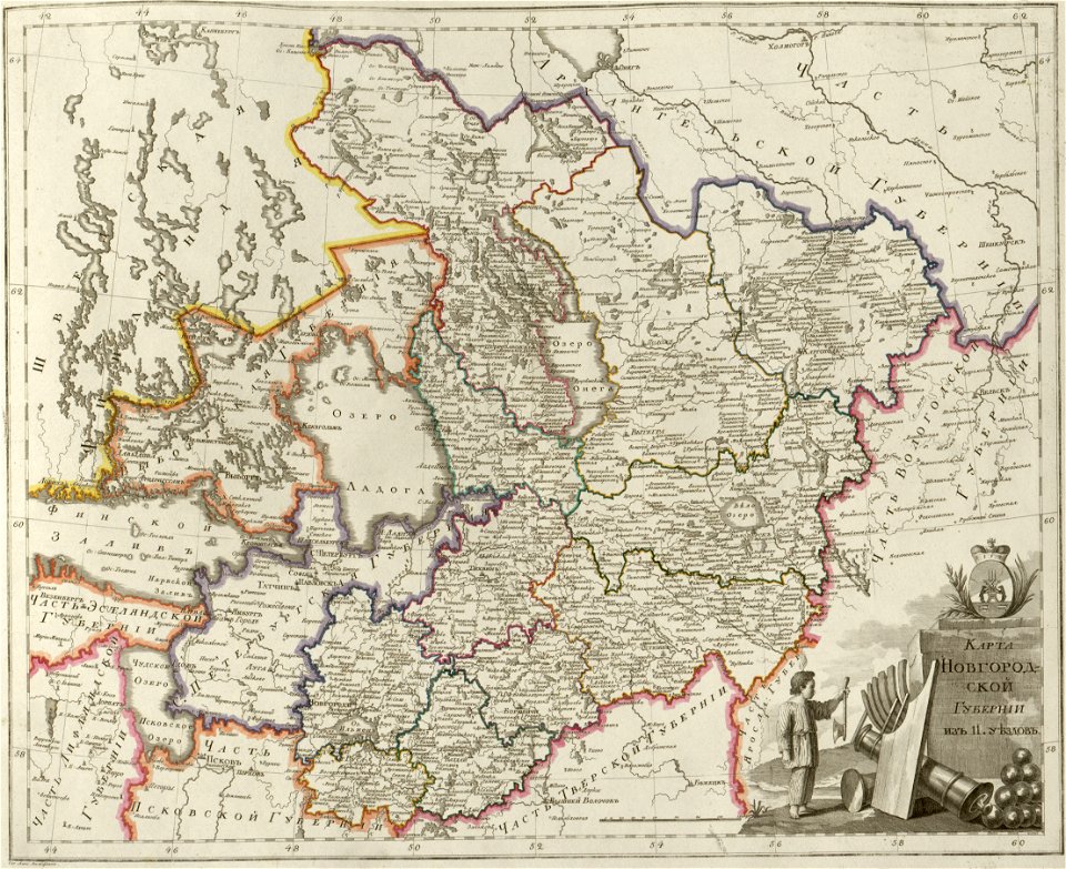
maps of novgorod governorate
atlas of the russian empire (1800)
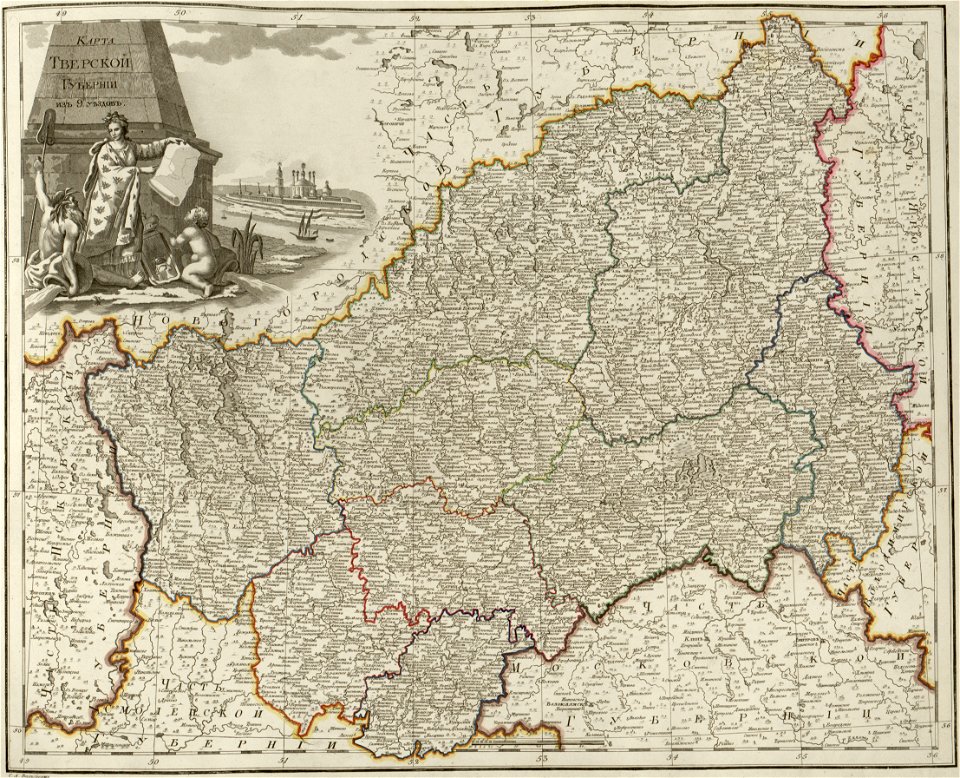
maps of tver governorate
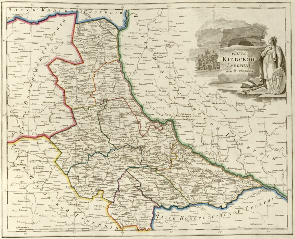
atlas of the russian empire (1800)
maps of kiev governorate
atlas of the russian empire (1800)
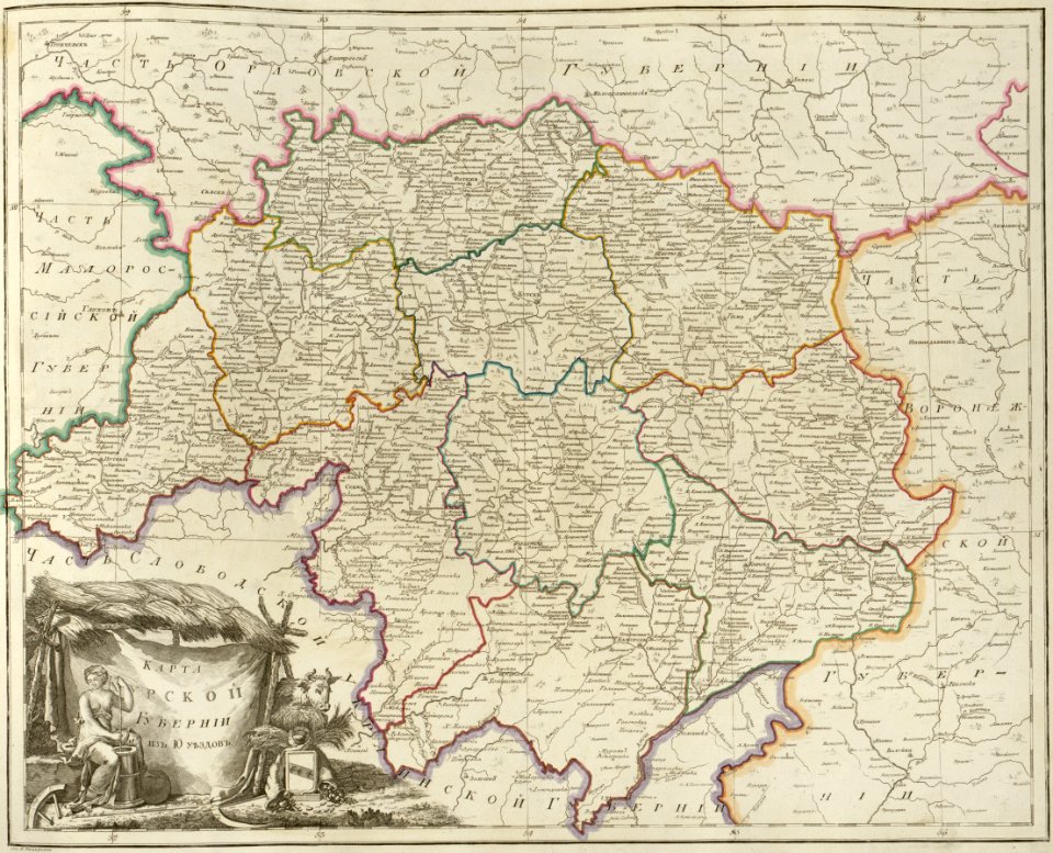
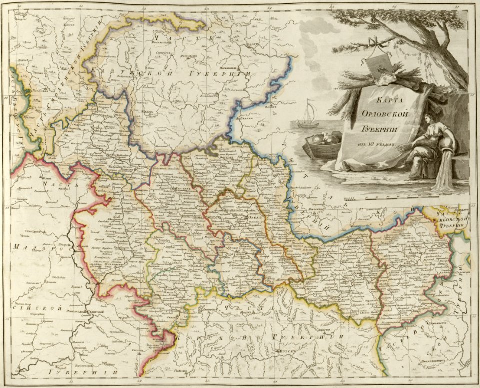
maps of oryol governorate
atlas of the russian empire (1800)
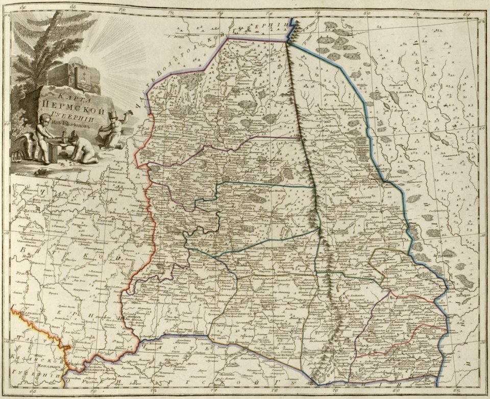
maps of perm governorate
atlas of the russian empire (1800)
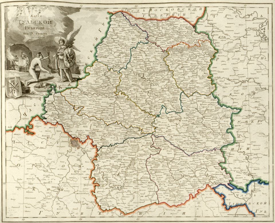
maps of tula governorate
atlas of the russian empire (1800)
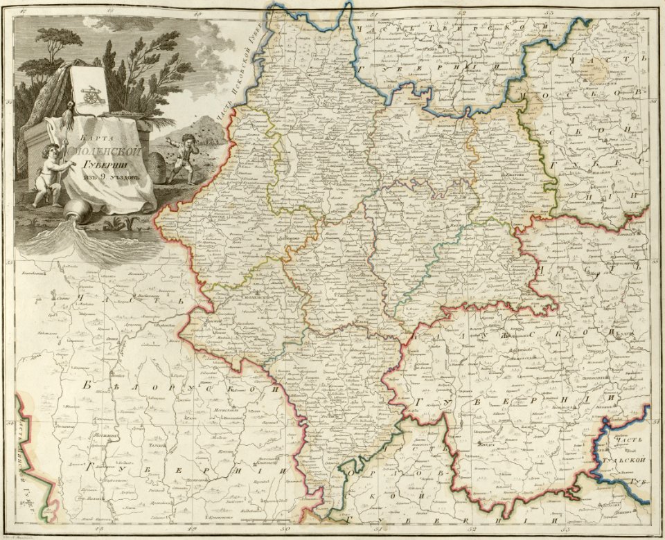
maps of smolensk governorate
atlas of the russian empire (1800)
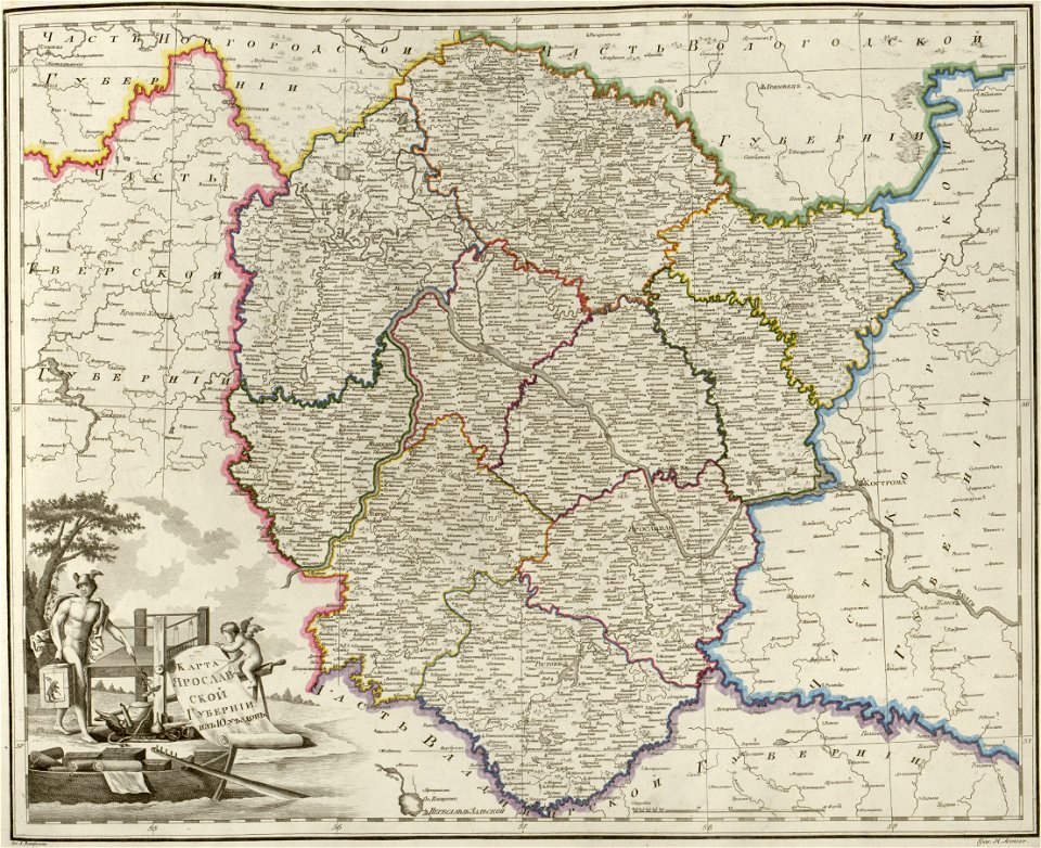
maps of yaroslavl governorate
atlas of the russian empire (1800)
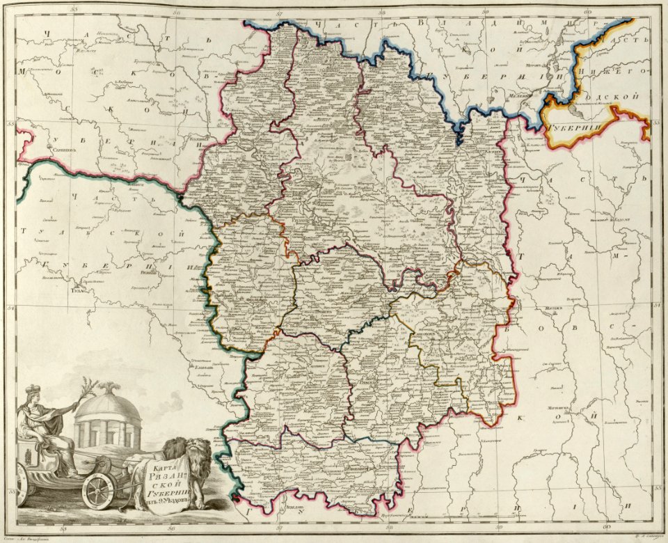
maps of ryazan governorate
atlas of the russian empire (1800)
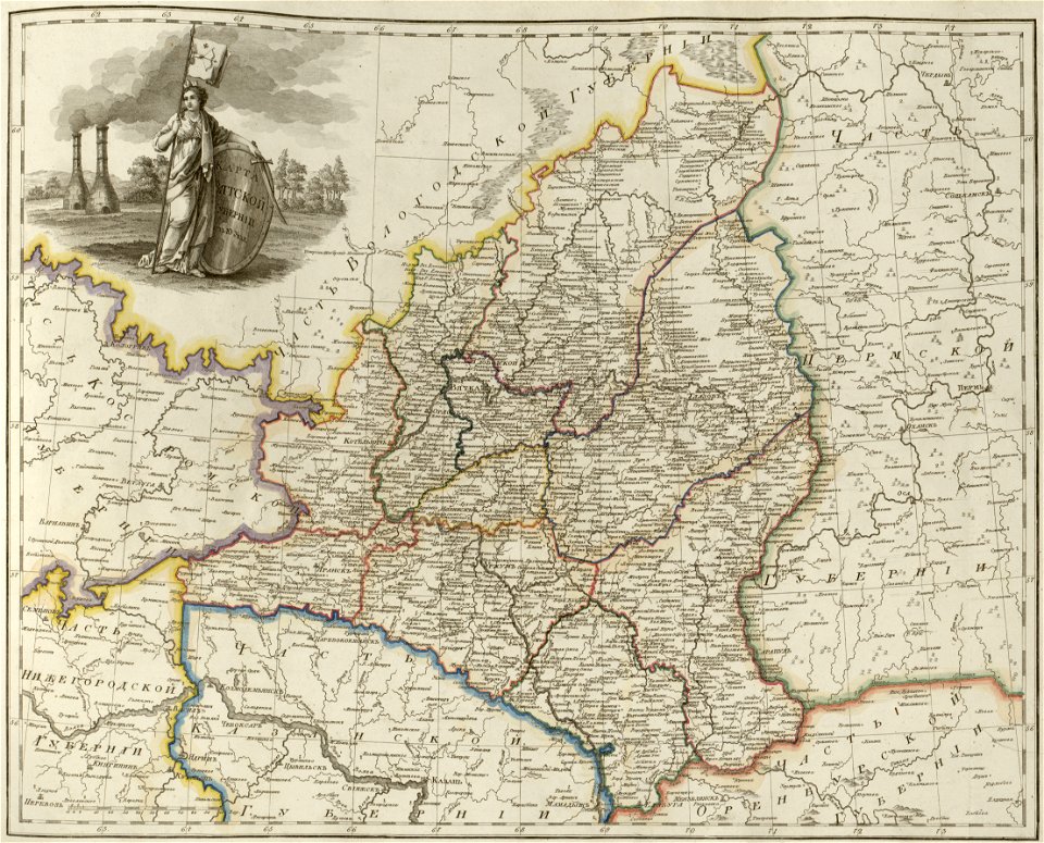
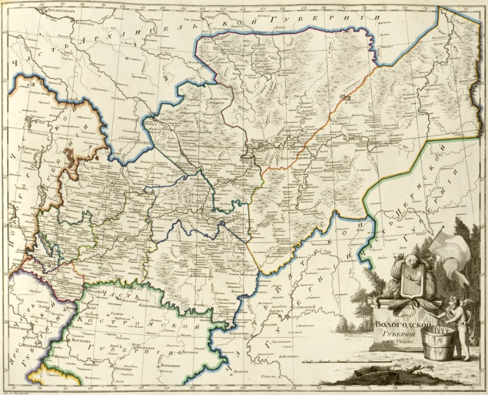
maps of vologda governorate
atlas of the russian empire (1800)
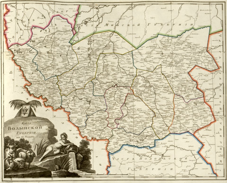
maps of volyn governorate
atlas of the russian empire (1800)
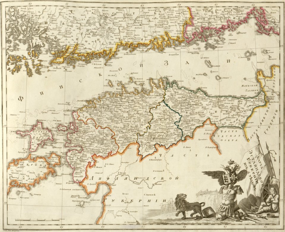
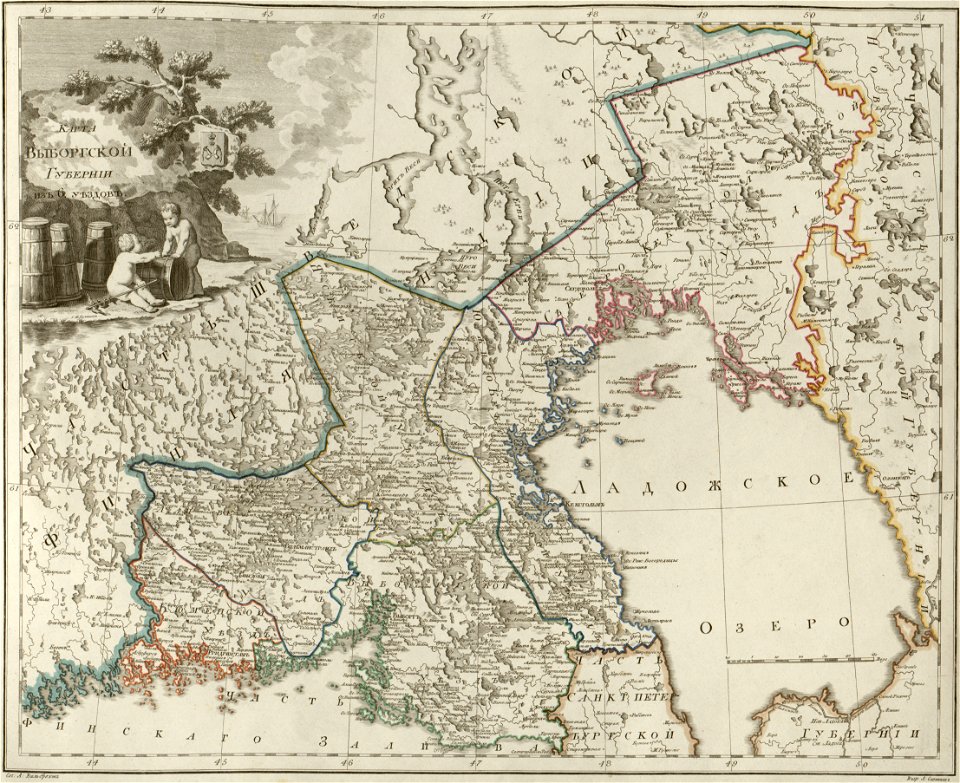
maps of wyborg governorate
atlas of the russian empire (1800)
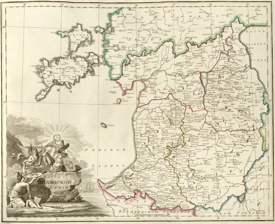
maps of liflandia governorate
atlas of the russian empire (1800)
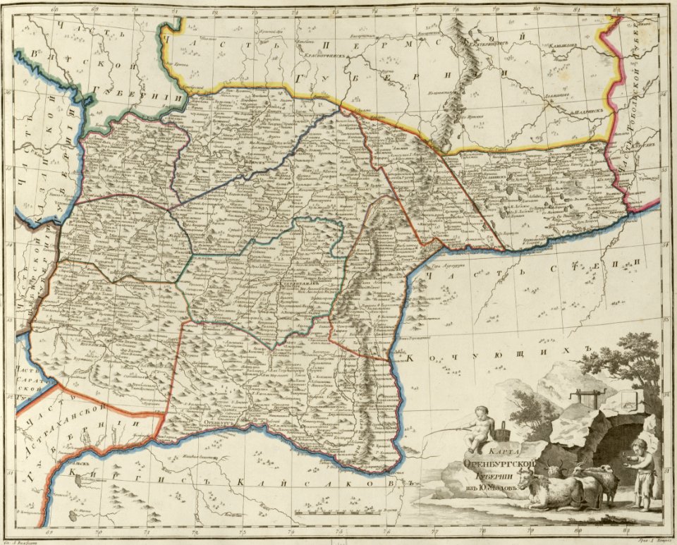
maps of orenburg governorate
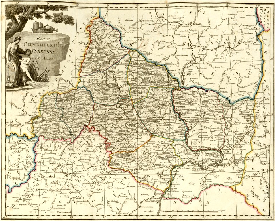
atlas of the russian empire (1800)
maps of simbirsk governorate
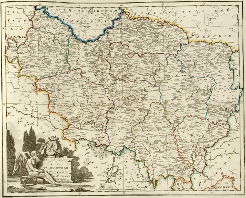
atlas of the russian empire (1800)
maps of vladimir governorate
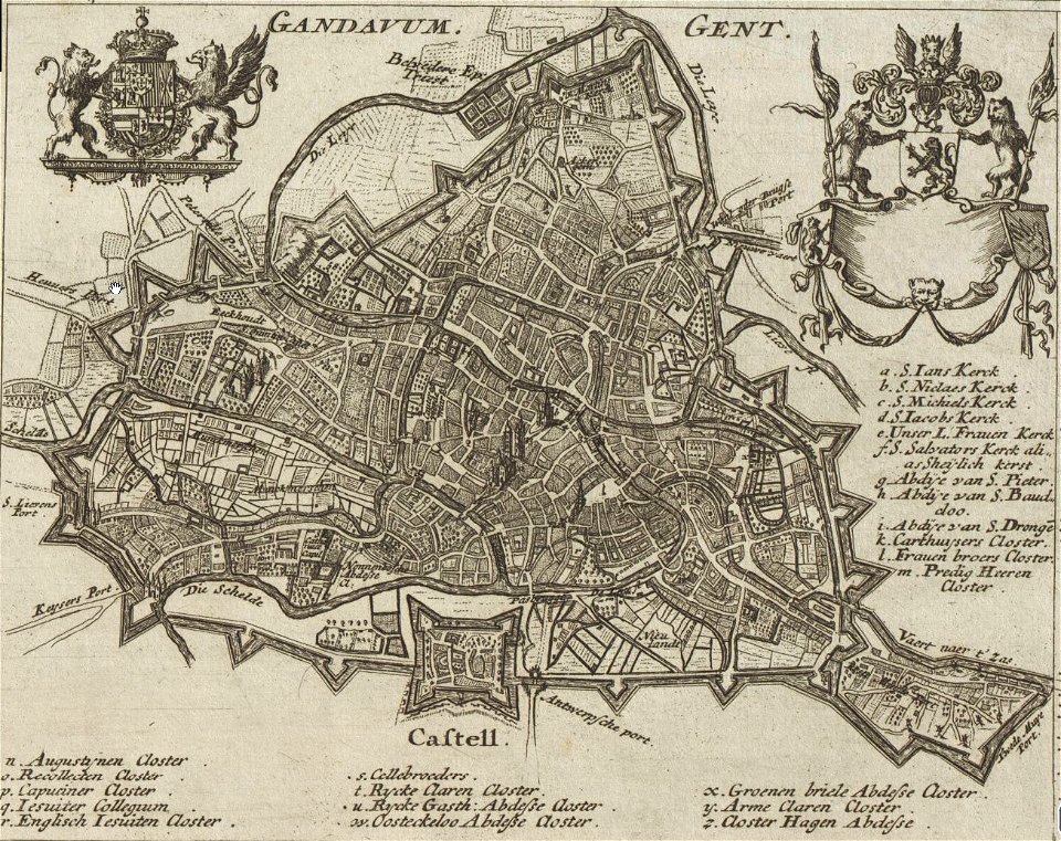
map of ghent by gabriel bodenehr
1725 maps of europe
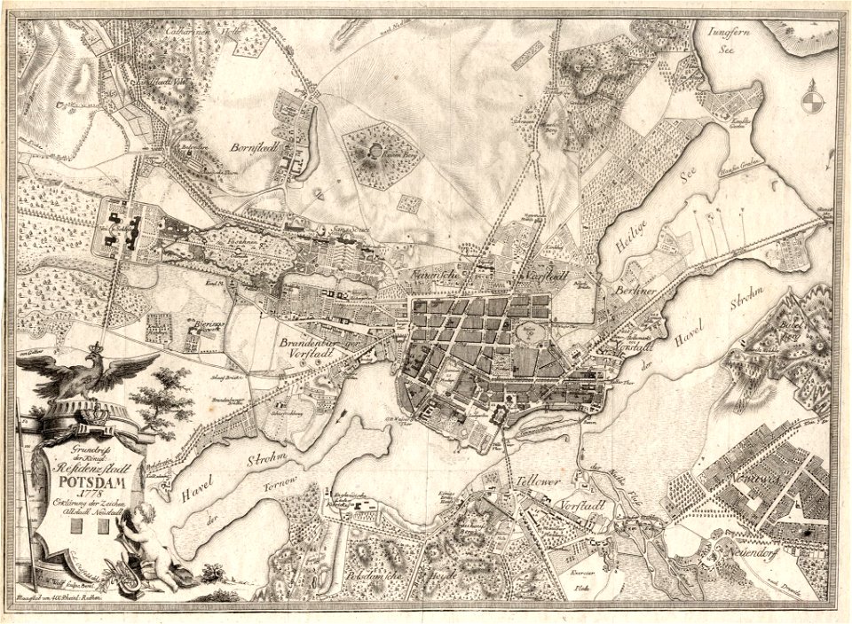
history of sanssouci
maps of potsdam
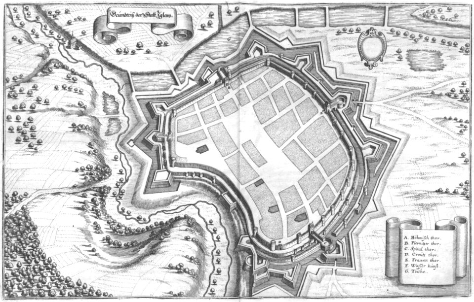
engravings of topographia bohemiae moraviae et silesiae
maps of jihlava
relation of a journey (sandys)
17th-century maps of jerusalem
small atlas of the russian empire (1796)
maps of kazakhstan
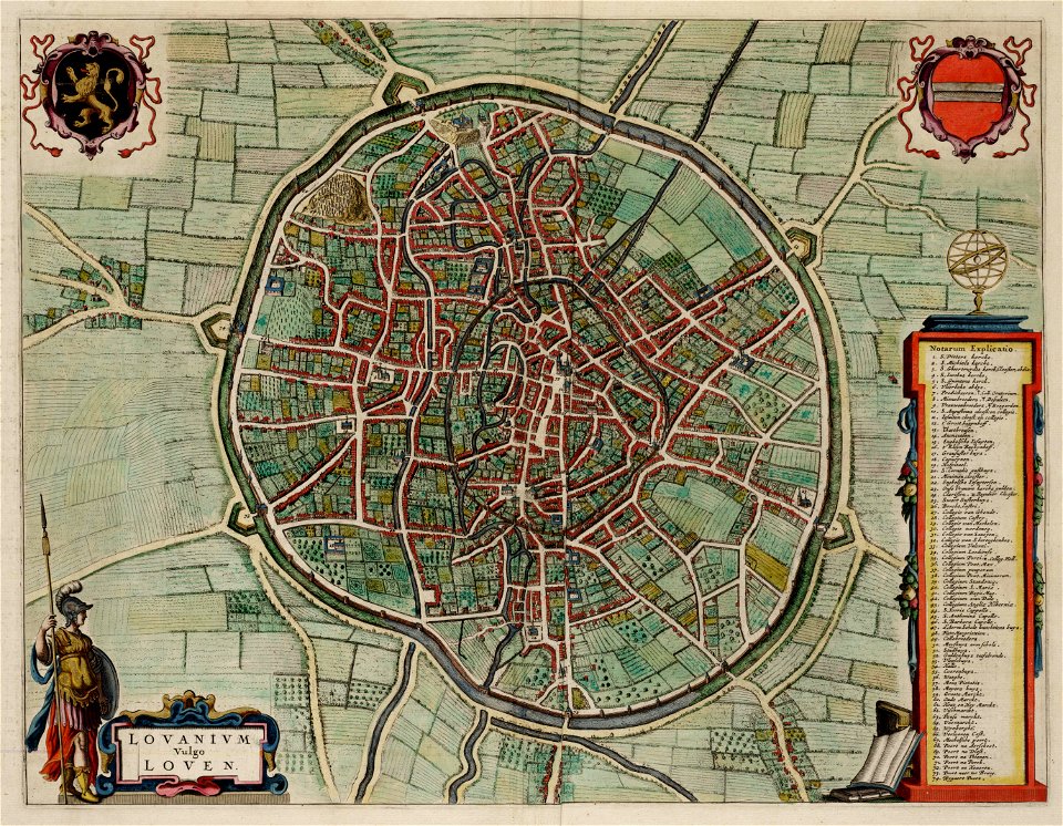
old maps of leuven
atlas van loon
geographical illustrations by coronelli
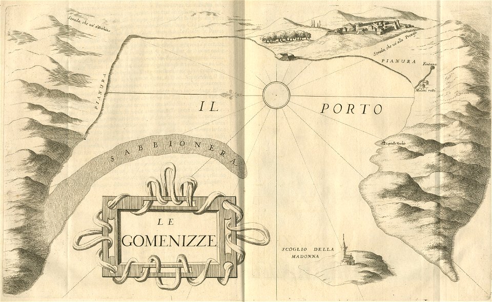
engravings of igoumenitsa
volume 7 of le tour du monde
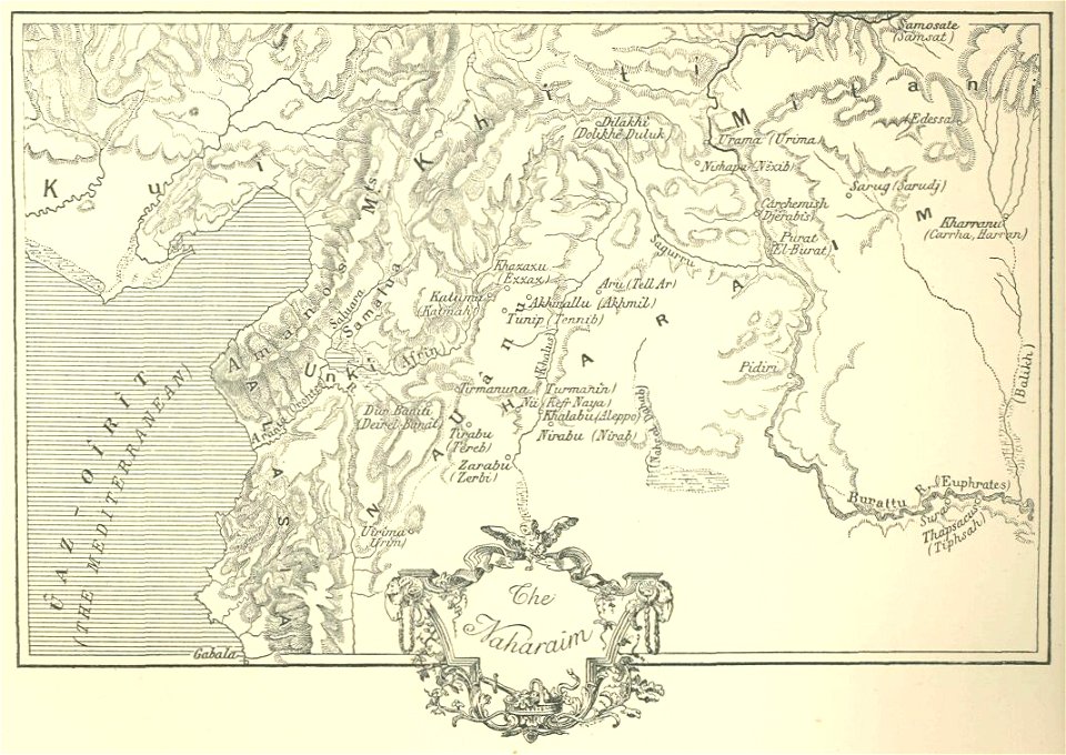
maps of nimrud
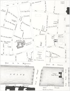
floor plans of paris
engravings of paris
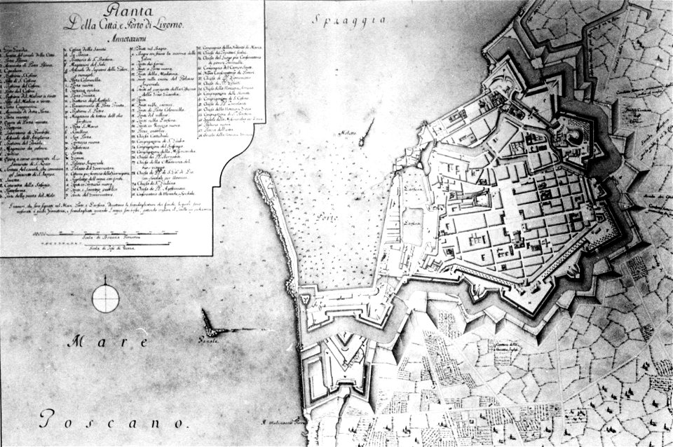
old maps of livorno
walls of livorno
atlas of the russian empire (1792)
maps of wyborg governorate
17th-century maps of schleswig-holstein
tönning
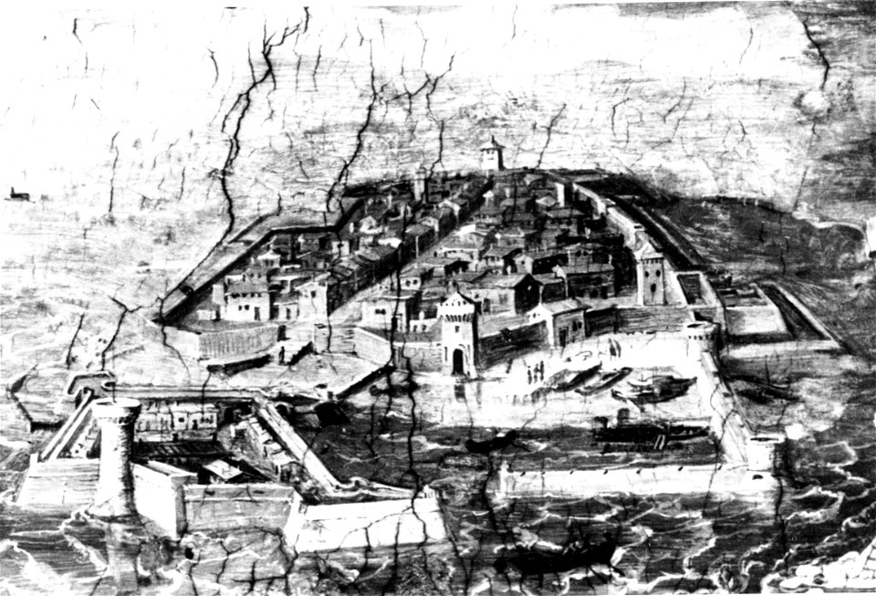
paintings of połacak by dmitry strukov
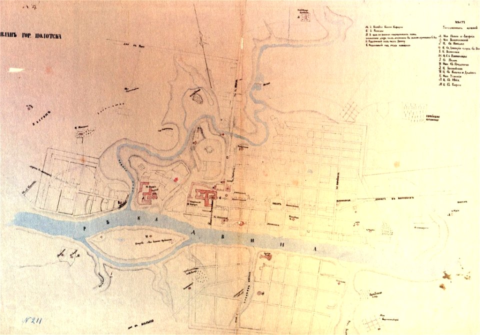
old maps of polotsk
old maps of livorno
walls of livorno
maps of the history of syria
books by gaston maspero
5901 - 6000 of 1,095,865
Next page
/ 10959